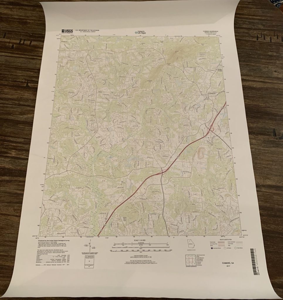
Having a backup copy of paper maps is always a good idea for any trip in remote areas. You never know when your electronic devices may fail, run out of battery or have other issues. I recently spent some time trying to figure out the best way to print USGS (US Geological Survey) topographic quad maps on paper, and after testing a couple of different methods I settled on one – printing the maps full size at Staples.com.
I compared the prices to print the maps at full resolution and quotes ranged from $35+ per map at FedEx Kinkos to $5.94 at Staples… Yes, that is correct. Printed full-size on 24” x 36” paper was only $5.94 at Staples. The map is printed on regular paper, not waterproof paper like Tyvek, but if you are using the maps for backup and have a safe and dry place to store them regular paper should work fine.
I used the GeoPDF format for a local USGS quad to test the process. You can download either GeoPDF or GeoTIFF (image) files directly from the USGS or USFS websites. Here are the links to both sites:
■ USGS – The National Map Viewer
■ USFS – FSTopo
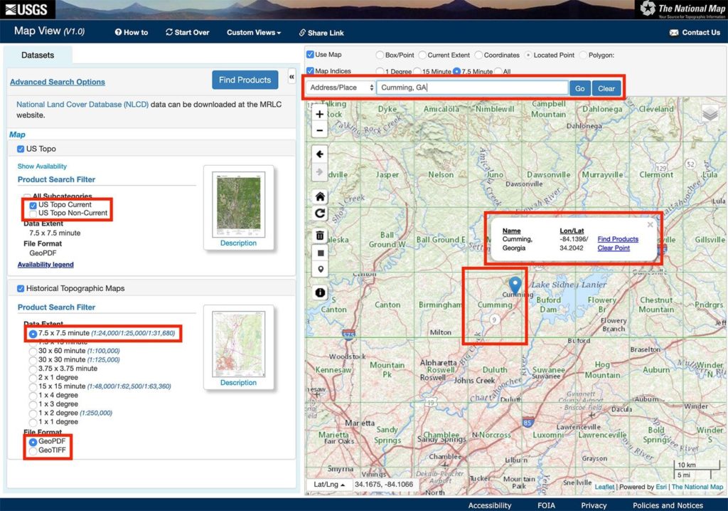
Using the USGS – The National Map Viewer
- Go to the USGS National Map Viewer site
- Search for the desired location in the search bar
- Click ‘US Topo Current’ for the current map generation
- Click ‘7.5 x 7.5 Minute’ (current USGS map standard size)
- Click ‘GeoPDF’ for a map in PDF format
- Each one of the squares on the map is an individual topo map. The name of the map is displayed in the center of the square
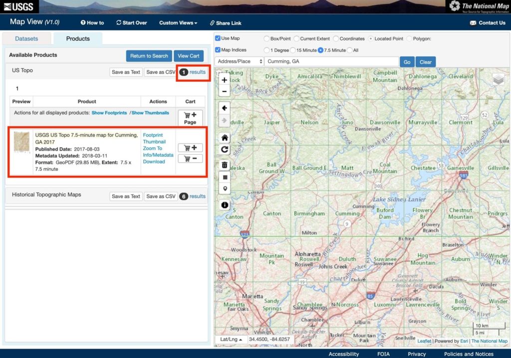
Next, search for available maps and download them:
- Click ‘Find Products’ in the window that appears above the map pin
- You will see the number of matching results (maps) in the ‘Available Products’ window that appears on the left – click the ‘results’ link
- The available maps will display, click ‘Download’
- You can also see historical (older) maps for the area by clicking the ‘results’ link in the ‘Historical Topographic Maps’ section of the ‘Available’ Products’ window
- Note the format and size of the map file (EX: GeoPDF, 29.85 MB)
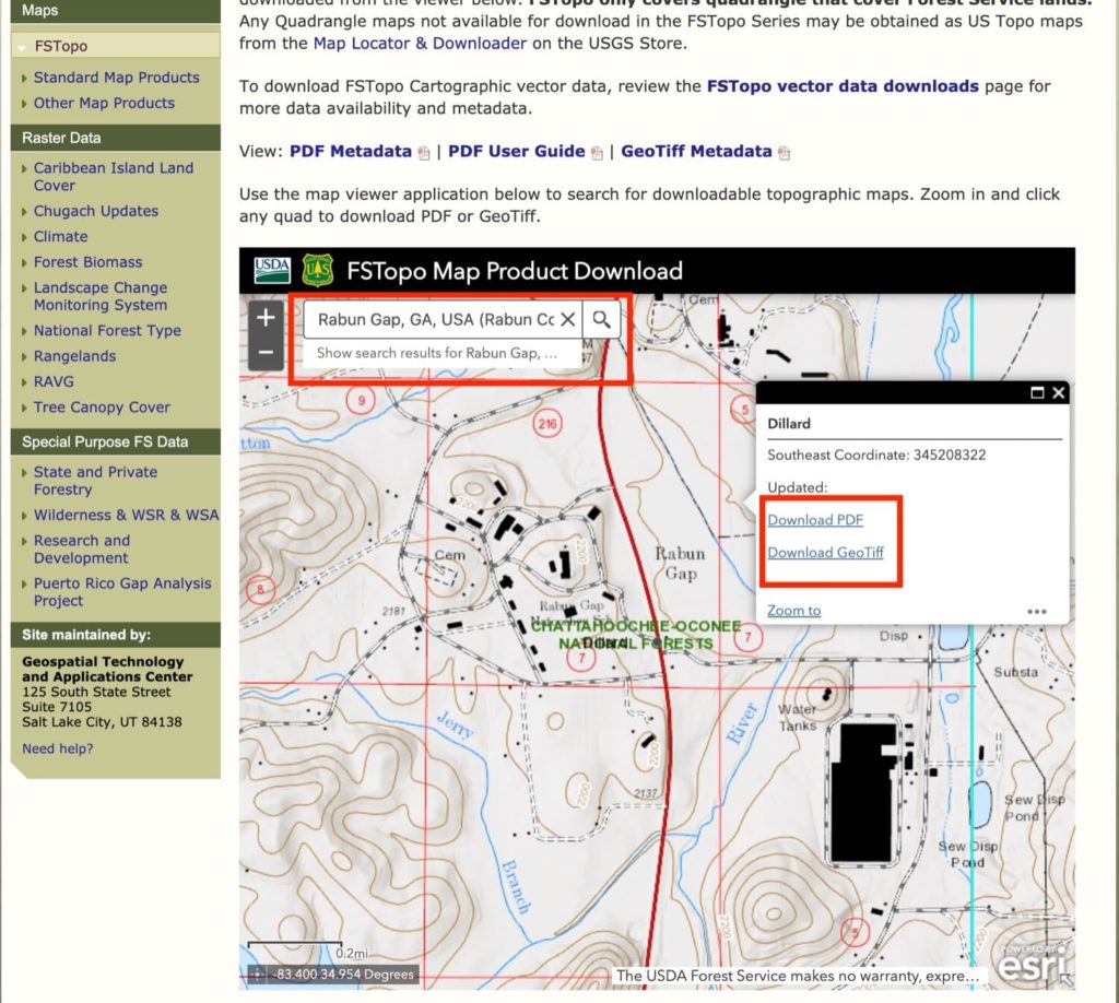
Using USFS (US Forest Service) FSTopo Viewer
- Go to the USFS FSTopo Viewer site
- Search for the desired location in the search bar
- Click on the map image (the actual topo map displays)
- Click the download link for either format – ‘Download PDF’ or ‘Download GeoTiff’
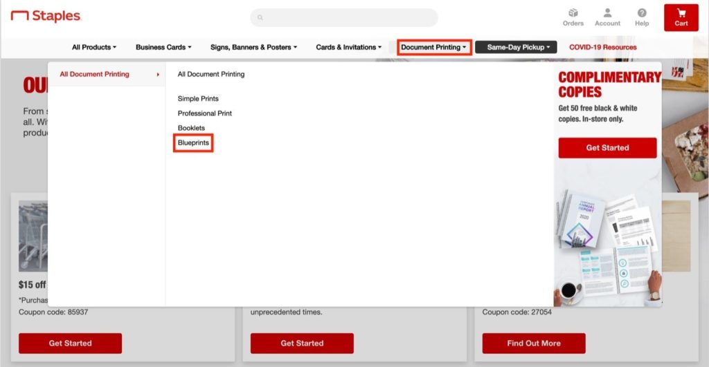
Next, head over to staples.com to create a printing project
- From the navigation bar click ‘Document Printing’ > ‘Blueprints
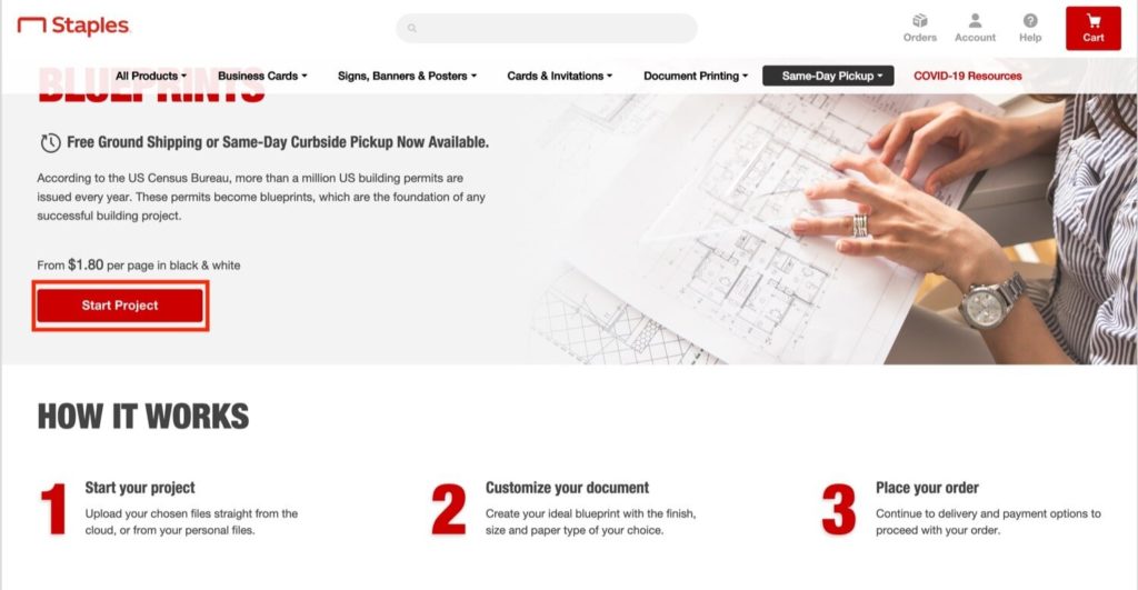
Click ‘Start Project’
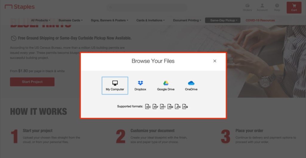
Select the map file(s) to upload for printing
- NOTE: These files are typically large (30-100+ MB) so it may take some time to upload depending on your internet connection
Make the following selections on the preview screen
- Paper Size – 24” x 36” (width x length)
- Uncheck ‘Scale to Fit’ (this will print the map at its native size/resolution and not scale it to make it larger so it fits the entire page)
- NOTE: It’s a good idea to double-check the physical size of the map PDF document to make sure the paper size you select will accommodate the entire map. You can do this either by viewing the file’s properties or opening it in Adobe Acrobat reader and clicking ‘Properties’ from the ‘File menu
- NOTE: Some of the USGS topo quad maps also include a layer for satellite imagery. It usually appears to not be on by default, but if you see the satellite imagery in your map print preview try opening the file with Adobe Acrobat reader and checking the layers to make sure the imagery layer is set to off

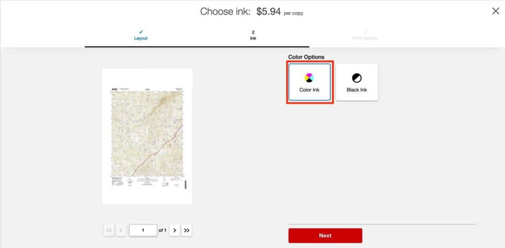
Select ‘Color Ink’
Complete the next 2 screens to select pickup in store or delivery and submit the order. I submitted my order around 9AM and it was ready by 6:30pm the same day.
9 Comments
JH
May 4, 2021 at 8:44 pmThis is great! Exactly what i am looking for. question though. The USGS recommends printing on 23×27, and I see that you used 24×36. Can you confirm that it did print exactly to scale using your method? It looks like you just ended up with extra (whitespace) margin space, correct?
Jeff Greenfield
October 15, 2021 at 1:13 amI looked into this, JH, as I had the same question. And I discovered the answer, and I just ordered some printed the way this author described. They’ll be ready tomorrow. Here’s what I found out: Staples doesn’t offer the 23×27 that the USGS recommends. They offer these sizes for “blueprints”: 18″x24″, 24″x36″ (as the author suggested), 30″x42″, and 36″x48″. No 23″x27″ is offered, only Staple’s standard sizes. You uncheck the box to fill the entire page with the image, so the scale is perfect at 100%. Yes, 24″x36″ is bigger than 23″x27″, but we get an image size of 100%. We merely cut off the extra white space, or just leave it. Make sure you pick the “color ink” option and not black and white as the colors of course are important in a topographical map.
C
February 15, 2022 at 11:09 pmAwesome information, just picked up my maps at staples, was able to print 2 varieties of usgs topo, a usfs topo, a local SAR topo, and threw in a Nat Geo topo 8.5×11 regular print job all for around $30 for complete mapping domination!
Colby
February 18, 2022 at 6:40 pmThanks! I’m glad you found it useful, much cheaper than buying pre-printed maps!
GB
March 10, 2022 at 6:52 pmStaples printed four USGS quadrangles on bond paper for me over the past several weeks, but as of this past Tuesday they’re refusing to print any more because they say the amount of color ink in the map will leak through the bond paper and damage their printer. I’ve tried two different local stores and they each told me the same thing when cancelling my order. They say I have to get it printed on poster paper rather than bond, which is not what I want. Why they’re telling me this *after* printing four maps for me, I have no idea, but there you have it.
Dheeraj
April 1, 2023 at 4:46 pmI have my local Staples told me the same thing. Did you find a solution?
Michael
July 20, 2023 at 7:08 pmSo glad I found this site. Picked up my first map from the local Staples today and it was just over $6 with tax. Looks great and very legible. Thanks for writing this up for everyone!
Colby
July 20, 2023 at 7:43 pmHi Michael,
Thanks for the comment and glad your local Staples was able to print it!
Darce
September 26, 2023 at 8:14 pmThis is great news. I am wondering how durable the paper is can it be folded and used for hiking like the military topo maps?