
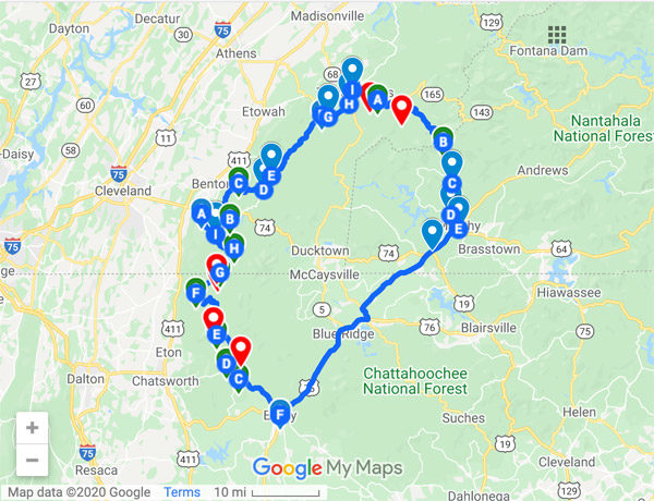
This is the second post in a series about Jeep trails in Georgia and off road trails in Georgia! This route starts in Summerville and travels across USFS Forest Service Roads and paved roads to Chickamauga in Northwest GA. There are several interesting points of interest and things to see along the route as well (see below).
Watch the video below for a preview of the route!
Special thanks to Shannon Reed for the video, photo and contributions to this route and post.
Corpsewood Manor
In 1977, Dr. Charles Schudder and his partner moved from Chicago to this location to build their dream home for retirement. They built the brick mansion by hand over the next few years, but the couple was murdered in December of 1982 as a part of an attempted armed robbery. Today only a few remains of the structure exist.
Much history exists around this estate and the murders. To learn more visit Atlas Obscura or do a Google Search for “Corpsewood Manor“.
The home site is not really visible from the road. Take Forest Service Road 259 – Hammond Gap and then on to Forest Service Road 259A – Hammond Gap Branch A to the point where the GPS route starts. Proceed down the hill to your left and follow the small path that runs to the home site.
Blue Hole
Blue Hole is a natural spring on the Crockford-Pigeon Mountain WMA in LaFayette, GA. The water in the hole is so clear you can see to the bottom of the hole. It also has a vivid blue color which gives the hole its name.
Pettyjohn Cave
The Crockford-Pigeon Mountain WMA is home to 2 extensive cave systems. Pettyjohn’s Cave is the third largest cave in GA and is located on the eastern face of Pigeon Mountain. It has 6.5 miles of trails underground and descends to a depth of 235 feet. The cave features multiple “rooms” such as the Echo Room which is the largest room in the cave.
Ellison’s Cave & Fantastic Pit
Ellison’s Cave is the home to Fantastic Pit, which at 586 feet deep is the largest vertical cave drop in the continental US. It is also the 12th deepest cave in the US and 12 miles in length underground. Ellison’s has 4 other pits as well – Incredible Pit at 440 feet deep, Smokey 1 (500 feet), Smokey II (262 feet) and Warm Up Pit (125 feet).
Ellison’s Cave is for very experienced or professional cavers only. There are signs at the information kiosk at Blue Hole that clearly state “THIS CAVE WILL TRY TO KILL YOU”. In fact, 3 people have died within the cave to date. Heed the warning and do you put yourself or others in danger by entering it if you are not an experienced/professional caver with the proper gear, equipment, experience.
US Forest Service Road Status
Please check the status of any Forest Service Roads that you plan to travel on prior to starting your trip. Visit the USFS Interactive Visitor Map and choose the search icon in the box at the top of the page and enter the name of the Forest Service Road. Click on the road name in the results and then click the map marker icon to view the details for the road.
It is also good practice to check the “Alerts & Notices” section of the USFS website for the forest that the road is in. When roads are closed they are typically updated on these pages. Click the links below to visit the page for the Nantahala or Cherokee National Forests.
Responsible use of USFS roads and any Jeep trails in Georgia in general will benefit all of us so the roads can be properly maintained and open for our enjoyment.
Forest Service Roads
■ 201 – Jenkins Gap (Open Yearlong | Gravel | Chattahoochee-Oconee National Forest)
■ 205 – S. Taylor Ridge (Open Yearlong | Gravel – High Clearance Vehicles | Chattahoochee-Oconee NF)
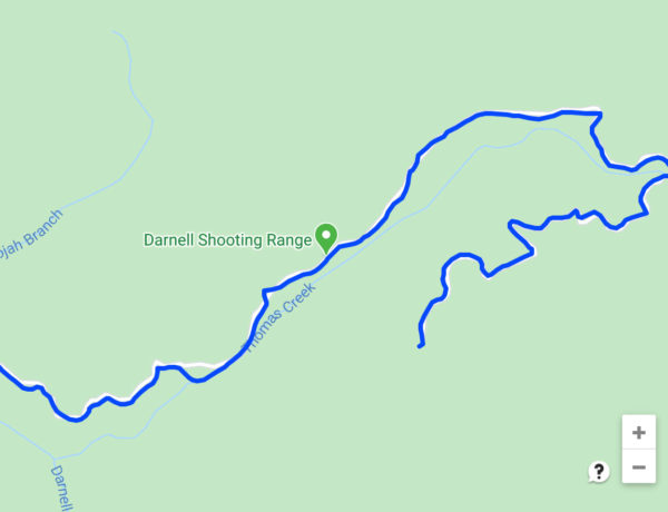
■ 259 – Hammond Gap (Open Yearlong | Gravel | Chattahoochee-Oconee National Forest)
■ 259A – Hammond Gap Branch (Br) A (Open Yearlong | Gravel | Chattahoochee-Oconee National Forest)
■ 252 – Ruff Creek (Open Yearlong | Gravel | Chattahoochee-Oconee National Forest)
■ 635 – Smith Gap (Open Yearlong | Gravel | Chattahoochee-Oconee National Forest)
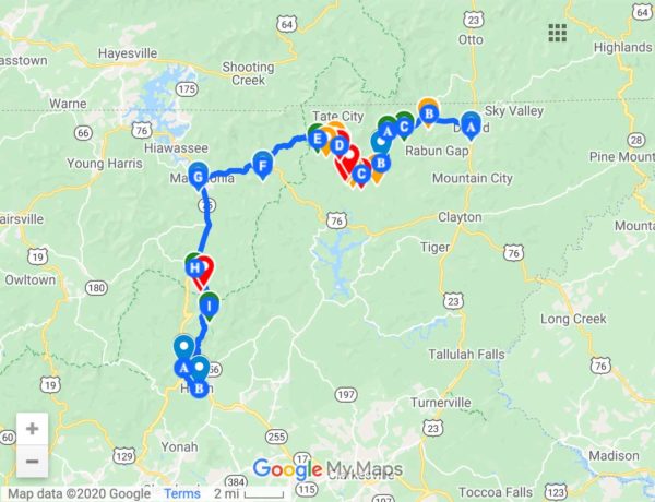
Total Length: 53.1 Miles | 1 Day
MAP PIN LEGEND:
Blue – Paved Road
Green – Forest Service Road
Red – Point of Interest
Google Maps
Click To Open Map In A New Window
Gaia GPS
Click To Open Map In A New Window
For more Jeep trails in Georgia also check out the GPS route from Dillard, GA to Helen, GA!
No Comments