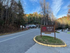
This route starts in Murphy, NC and travels across US Forest Service and paved roads to Deals Gap, NC. At Deals Gap it picks up at US Hwy 129 which is also known as the “Tail of the Dragon”. The route ends at the north entrance to the Tail of the Dragon on the TN side. This route has many interesting things to see along the way as highlighted below!
There are also several alternate routes (with waypoints and additional points of interest) that continue on from the end of Hwy 129 – see the legend section of the map that is embedded below. Click the checkbox on any of the layers that start with “ALT” to view the those points on the map. Downloadable files for the route are available in GPX and KML formats via the links below as well (above the map).
Tail of the Dragon
US Hwy 129 gained its nickname the “Tail of the Dragon” because it has 318 sharp curves over the course of 11 miles. It is very popular with motorcycle riders and sports car drivers, and many of them drive the road at very high speeds. There are photographers that are stationed at various curves along the road who take photos of each vehicle throughout the day. You can buy the photos online if you would like a copy of them. I ended buying all 10 (see 3 of them below the map)! If you drive the road on the weekend please drive slow, stay in your lane and watch out for oncoming cars. Multiple accidents and even fatalities occur on this road every year.
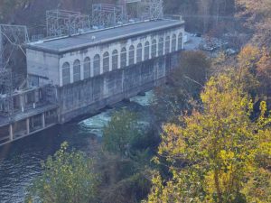
Cheoah Dam & Powerhouse
The Cheoah Dam is a 225 foot high hydroelectric dam and powerhouse that was completed in 1919.
It was also the site of the “dam scene” in the 1993 movie The Fugitive which starred Harrison Ford. You can watch the scene on YouTube as well.
Cheoah River Rapids
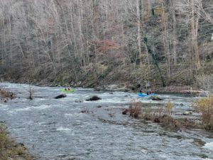
The Cheoah River has a series of rapids, and the largest one is Bear Creek Falls which is near the end of the whitewater stretch and north of the Tapoco Lodge. Bear Creek Falls is a class IV+ (very difficult) rapid with a 12-foot vertical drop. This stretch of the river is popular with rafters and kayakers. See the video of the kayakers below!
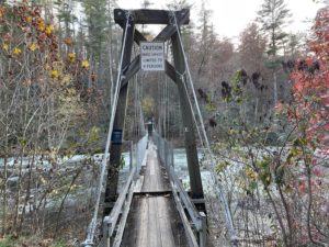
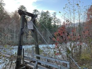
Cheoah River Suspension Bridge
This narrow foot suspensions bridge crosses the Cheoah River in Robbinsville, NC. Its capacity is limited to only 4 people at a time.
Tapoco Lodge
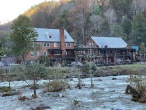
The Tapoco Lodge is a historic structure that is located on the banks of the Cheoah River just downstream from the Bear Creek Falls rapid. There are additional rapids near the lodge, and you view them from the lodge deck or the area down by the river. The lodge also has a restaurant and tavern that offers local craft beers, and is a great place to stop for a bite to eat before you drive the Tail of the Dragon (or after)!
US Forest Service Road Status
Please check the status of any Forest Service Roads that you plan to travel on prior to starting your trip. Visit the USFS Interactive Visitor Map and choose the search icon in the box at the top of the page and enter the name of the Forest Service Road. Click on the road name in the results and then click the map marker icon to view the details for the road.
It is also good practice to check the “Alerts & Notices” section of the USFS website for the forest that the road is in. When roads are closed they are typically updated on these pages. Click the links below to visit the page for the Nantahala or Cherokee National Forests. Responsible use will benefit all of us so the roads can be properly maintained and open for our enjoyment.
Forest Service Roads:
■ 420 – Davis Creek (Open Yearlong | Gravel | Nantahala National Forest)
■ 420-1 – Davis Creek 1 (Open Yearlong | Gravel | Nantahala National Forest)
■ 210 – Tellico River (Open Yearlong | Mostly Paved | Cherokee National Forest)
■ 216 – North River Shortcut (Open Yearlong | Gravel | Cherokee National Forest)
■ 217 – North River (Open Yearlong | Gravel | Cherokee National Forest)
■ 81 – Upper Santeetlah (Seasonal – Open 4/1 to 12/31| Paved | Nantahala National Forest)
Additional Points of Interest:
■ Tail of the Dragon Scenic Lookout
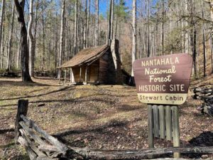
■ Stewart Cabin Historic Site
■ Blue Hole Public Fishing Area
■ Multiple Campgrounds Along Forest
Service Road 210 – Tellico River Rd
Total Length: 76.5 Miles | 1 Day
