Trail Info:
■ Distance: 3.2 miles
■ Trail Type: Out and Back
■ Elevation Change: 983′ Ascent (Uphill)
■ Hiking Time: 2 – 2.5 Hours
■ USGS Topo Quad Map: Rabun Bald
■ USFS Topo Quad Map: Rabun Bald
■ Mountain Range: Blue Ridge Mountains
At 4,696 feet Rabun Bald is the second highest mountain peak in GA, to only Brasstown Bald at 4,784′ feet. Standing atop the old US Forest Service fire lookout tower at the summit, Rabun Bald offers 360-degree panoramic views as far as 100 miles of the surrounding area!
Rabun Bald is located in Sky Valley, GA which is in Rabun County. It is due east from the town of Dillard, GA off of Highway 441 / US 23 and north of the larger town of Clayton, GA.
Hiking Trail
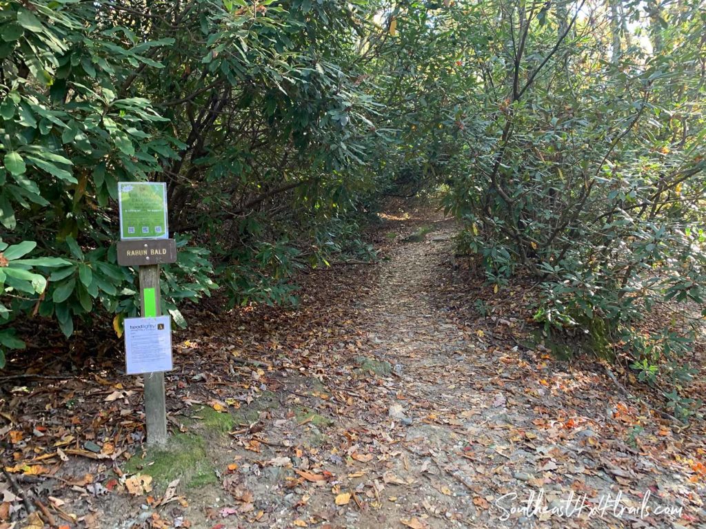
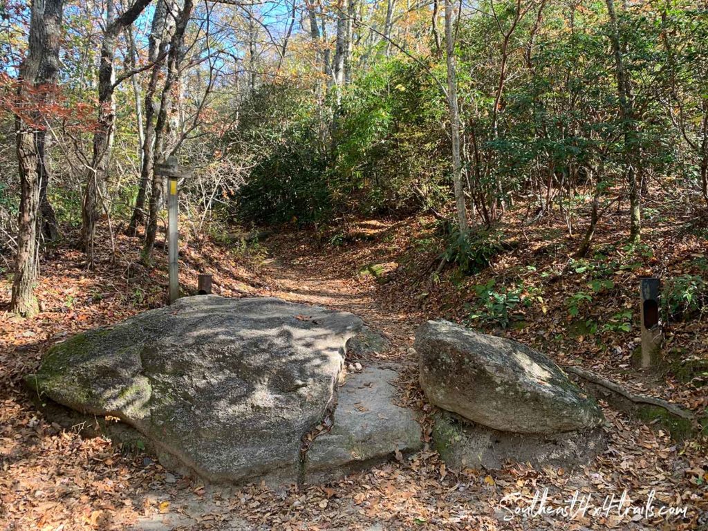
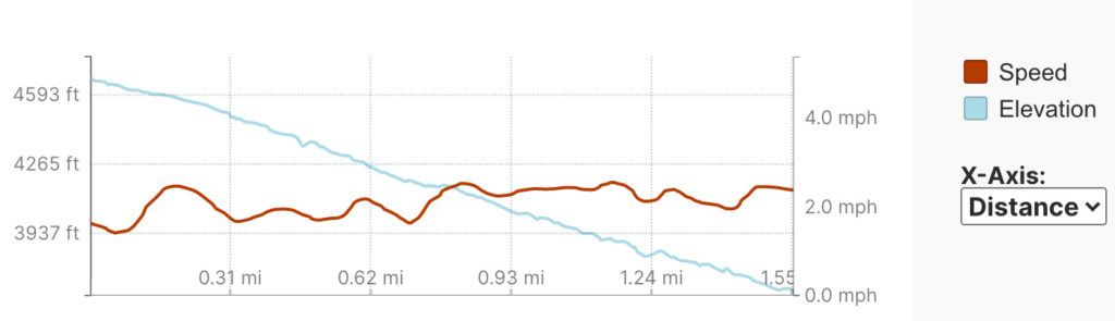
The route starting at Beegum Gap offers the shortest route to the summit of Rabun Bald at a round trip distance of 3.2 miles. The ascent up to the summit is a steady uphill climb. The trailhead is at approximately 3,660 feet and the base of the fire lookout tower is at 4,673 feet. It took us about an hour to hike the uphill portion, and about 50 minutes back down to the trailhead from the summit.
Click each pin on the ‘Rabun Bald – Hiking Trail’ map below for photos
There are also 3 longer hiking trails to Rabun Bald. One route is 5.4 miles and starts off of Hale Ridge Rd and approaches the summit from the eastern face. The other is 7.9 miles also starts off Hale Ridge Rd, but intersects with the Beegum Gap trail and follows it to the summit. A third route is 8.1 miles and follows the Bartram Trail where it starts off Hale Ridge Road and also intersects with the Beegum Gap trail and follows it to the summit as well.
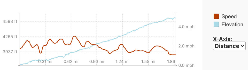
Elevation Profile – Hike up to the Summit
Elevation Profile – Hike Down to the Trailhead
History of Rabun Bald
Historical Society – rabunhistory.org
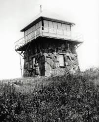
According to the Wikipedia page for Rabun Bald, the old lookout fire tower at the summit was the first of such towers that were constructed in this area. The photo to the left is of the original metal-framed “cabin” that was on the top of the tower’s stone base. It was constructed by Nick Nicholson, who was the first forest ranger in Georgia.
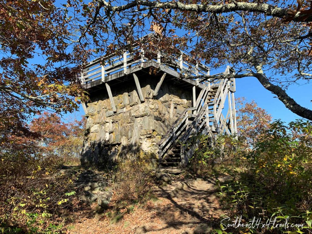
The cabin was operated by the US Forest Service until the early 1970s until it was taken out of service. The cabin was dismantled and the current wooden observation deck was constructed by the Youth Conversation Corps in its place.
Another fun fact from the Wikipedia page is that per Native American legend, Rabun Bald is inhabited by fire-breathing demon people. Some campers have reported hearing strange sounds throughout the night…
U.S Coast & Geodetic Survey Reference Mark
At the summit of Rabun Bald, to the left of the stairs to the observation platform a reference mark for the U.S. Coast & Geodetic survey is affixed to a rock.
The reference mark contains the following inscription:
“U.S. Coast & Geodetic Survey Reference Mark”
“NO. Rabun 2 1933”
“For Information Write To the Director, Washington D.C.”
“$250 Fine or Imprisonment For Disturbing This Mark”
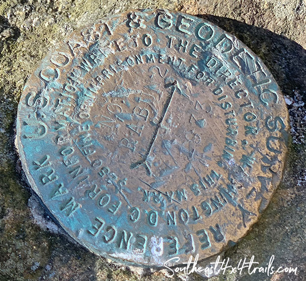
atop Rabun Bald – Set in 1933
Back before the times of GPS and modern surveying methods, these reference markers were placed at specific locations throughout the US. The markers were used for triangulation surveys, which were a way to establish angles and distances between various points. These measurements served as a basis for early map-making efforts across the United States.¹
The Geodetic Survey markers were typically set up in groups. In the triangulation method, a primary point was identified and deemed the “main station”. The reference mark for the main station was brass and contained a triangle emblem on the marker surface. Typically 3 other “triangulation stations” were set up for a given main station, and each of the triangulation station reference markers had an arrow (as seen in the photo above) that pointed back to the main station.¹
NOAA (National Oceanic and Atmospheric Administration) maintains the National Geodetic Survey (NGS) and a national database for the associated reference markers. Each of the markers are assigned a unique identifier called a PIN or Permanent IDentifier. Each marker also has a “data sheet” that contains information about the marker and its history. The PIN for the reference mark on Rabun Bald is ED1439. To view a map of the reference markers visit the GPS on Bench Marks for the Transformation Tool and search for ‘ED1439’ or the National Geodetic Survey Data Explorer tool.
Driving Directions
To reach the trailhead at Beegum Gap, head north on GA 441 and pass through the town of Dillard. At the stoplight, take a right onto GA 246 / Dillard Rd and continue for approximately 7 miles.
Take a right onto Hale Ridge Rd where the Scaly Mountain Outdoor Center is located (you will see a hill with a tubing track on your right). Continue on Hale Ridge Rd, then take a right onto Bald Mountain Rd.
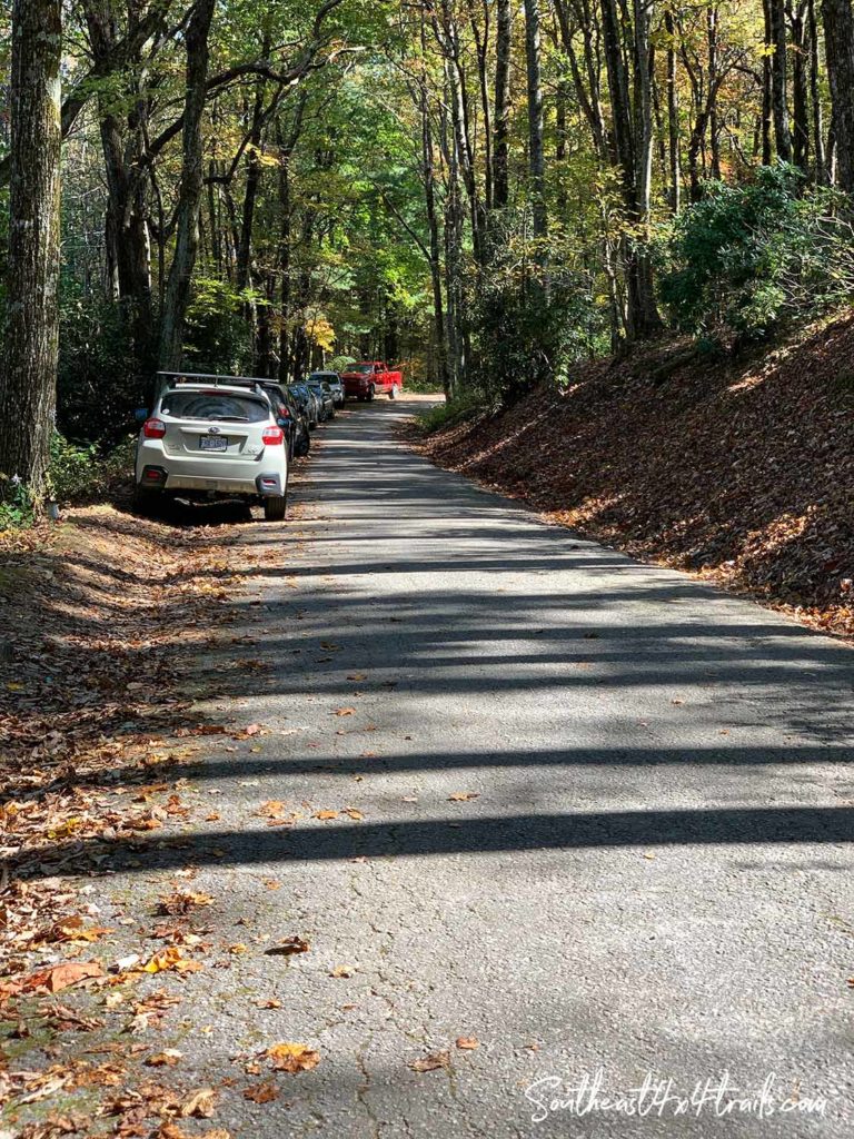
Take a right on Kelsey Mountain Road and continue slowly until you find a place to park on the side of Kelsey Mountain Rd. This is a popular hike, so parking spots may be limited on Kelsey Mountain Rd. There is no parking lot for the trailhead.
How to Print USFS & USGS Topo Quad Maps
If you are interested in learning how to print full-size paper copies of USGS or USFS topo maps such as the one for Rabun Bald, take a look at our post Printing Full-Size USGS or USFS Topo Quad Maps at Staples (for only $5.94)!
No Comments