Judaculla Rock
552 Judaculla Rock Rd
Cullowhee, NC 28723
Jackson County
Nantahala National Forest
Near Sylva, NC & Western North Caroline University
Coordinates:
N 35.30126, W -83.11021
Click the sidebar on the map for more information
The information on this page is adapted from the educational signs at the Judaculla Rock site and from the websites that are referenced below. I have paraphrased it here to tell the story of this important historical and cultural place. It is not an original work of my own. Please visit the Blue Ridge Heritage Trail site or Jackson County NC Recreation/Parks Department for more information.
As the Cherokee Indian legend is told, Judaculla was a god of the spirit world and the master of all game animals. He lived high atop Tanasee Bald within the Great Balsam Mountain range, and from the next mountain top over upon his “judgment seat” he presided over all who partook in the hunting of his game. Judaculla’s Judgement Seat is known as the Devil’s Courthouse today. ¹
One day a group of disrespectful hunters passed through his land, and Judaculla jumped down from his judgment seat high in the mountains and landed on a large boulder in the Caney Fork valley (at a distance of over 10 miles and an elevation change of 3,200 feet).¹
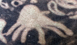
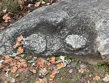
As Judaculla landed on the boulder, he put his hand down to steady himself which left an impression on the rock’s surface. He also drew a sharp line across the face of the rock with the nail of his right index finger to remind anyone that harm would come to those who crossed the line without first going through the appropriate rituals.¹ Both the line and the imprint of his hand can be seen on Judaculla Rock today.
The name Judaculla is an anglicized (English) pronunciation of the Cherokee name Tsul ‘Kalu and means “he has them slanting” which is referring to his eyes. He was known to the Cherokee people to be a slant-eyed giant, and they included his name in their various formulas, rites, and rituals to invoke his favor and success in hunting.¹
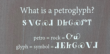
What is a Petroglyph?
A petroglyph is a form of “rock art”. Native Americans inscribed these images into the face of the rock by methods such as pecking, abrading or scratching.
Petroglyphs can have many meanings. Sometimes they were created or used during rituals or ceremonies, while others may tell a story, mark an important event or serve as a map.
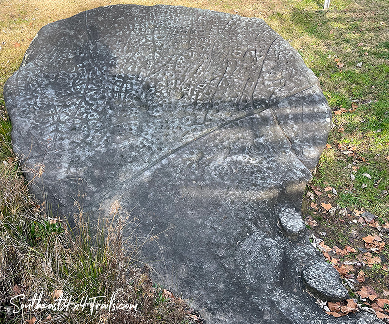
Petroglyphs on Judaculla Rock
There are about 1,548 petroglyph designs on Judaculla Rock. This is more than any known boulder in the Eastern US. These petroglyphs symbolize important places, stories or events.
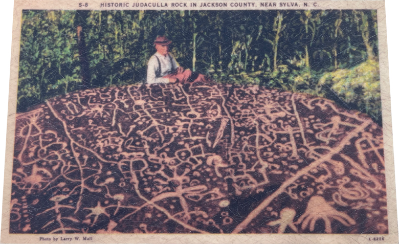
chalk so the petroglyphs were easier to see ²
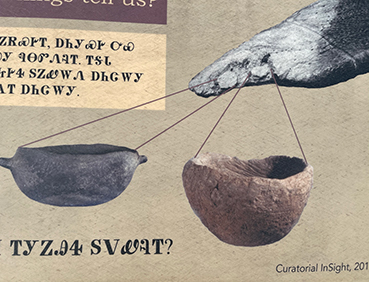
Archaeologists and researchers believe that use of the site surrounding Judaculla Rock started about 3,000 years ago when soapstone was quarried from the rock to make bowls. You can still see the remnants of the soapstone that was quarried on the lower left-hand side of the rock.
Long after the quarrying stopped the petroglyph carvings are thought to have started around 1,500 years ago and continued up until 300 years ago.
There are several different theories on the meaning of these petroglyphs. Some think that Judaculla Rock served as a boundary marker for Cherokee hunting grounds.
Another theory is that the petrogylphs are a three-dimensional picture map of Judaculla’s world.¹ Yet other theories suggest that the markings tell of how one can enter into the spiritual world or that they are a map of the Battle of Taliwa where the Cherokees defeated the Creek tribe in 1755.³
Judaculla Area Landscape
In the 800 square mile area surrounding the Judaculla Rock site there are 12 place-names and features that reference Judaculla’s name. Early settlers called the Tanasee Bald area ‘Judaculla Old Fields’ and it was considered to be both his farm and one of his underworld entryways.¹
Below Tanasee Bald and the Devil’s Courthouse lie the Judaculla Ridge and Old Bald Ridge which were believed to be large fields that Judaculla once farmed. The granitic dome mountain named Looking Glass Rock is where Judaculla saw his own reflection. When the mountain is wet or icy, the granite cliff reflects light. It is said that only a giant would be able to stand so tall and see his reflection at those heights (3,969 feet).¹ Judaculla Mountain lies to the north of Judaculla Rock as well.
The surrounding town of Cullowhee is an anglicized (English) form of ‘Judaculla-whee’ which means Judaculla’s Place.¹ Cullowhee is six miles northeast of Judaculla Rock and is a historic Cherokee town and was also the site of a council house mound.
Judaculla Rock Site Today
The Judaculla Rock site is owned by Jackson County, NC today. In 1959 the Parker family that still owns the surrounding farm donated 1 acre to Jackson County for the site.
For nearly 100 years, the Parker family has served as a benefactor of the larger Judaculla Rock site to protect it from vandalism that has defaced or destroyed a number of other petroglyph sites in North Carolina. 107 acres of the surrounding Parker family farm was placed into a permanent conservation easement that will continue to protect the broader cultural site and preserve it from any development in the years to come.
Signs
Click the images below to view a photo of each one of the signs that are posted around the site.


More Information
Resources & Citations
- North Carolina Highway Historical Marker Program
- Scott Ashcraft & Lorie Hansen – N.C. Rock Art Project
- DJR04.com – Reggie Duke
No Comments