
I came across the bridge by chance on the way home from a trip to Forest Service Road 39 / Duncan Ridge Rd recently. Located in Suches, GA (Fannin County) off of Hwy 60 you can take Forest Service Road 816 (Tooni Gap) 3.39 miles to a parking area. The hike down to the bridge from the parking area is about 1/4 mile.
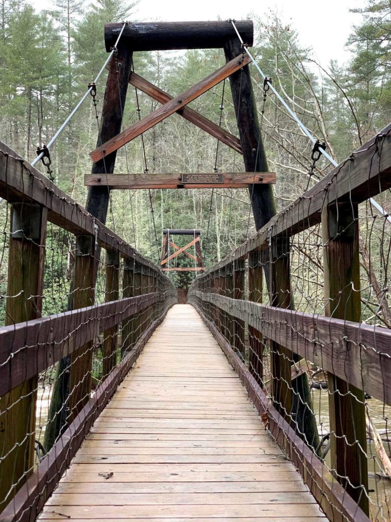
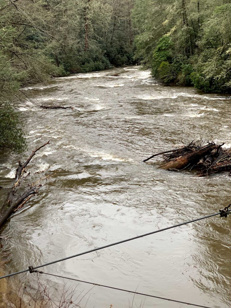
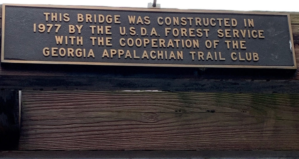
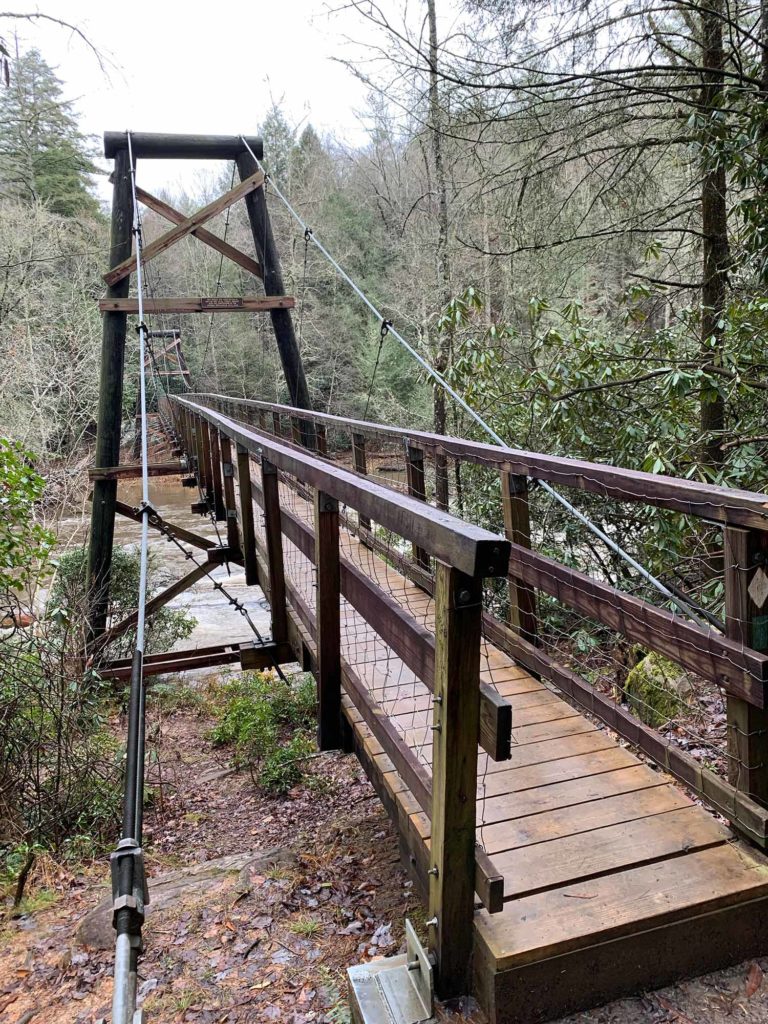
The bridge was built in 1977 by the US Forest Service with assistance from the Georgia Appalachian Trail Club to provide a safer way to cross the Toccoa River (as opposed to attempting to ford the river). It connects the Duncan Ridge Trail over the Toccoa to where it meets up with the Benton MacKaye Trail. Spanning 270 feet, the bridge is the longest swinging bridge east of the Mississippi. Crossing the bridge is an exciting experience as the it bounces with each footstep and sways right and left!
There are primitive campsites below the bridge at the Toccoa River as well. It is definitely worth visiting the next time you are in the Suches area!
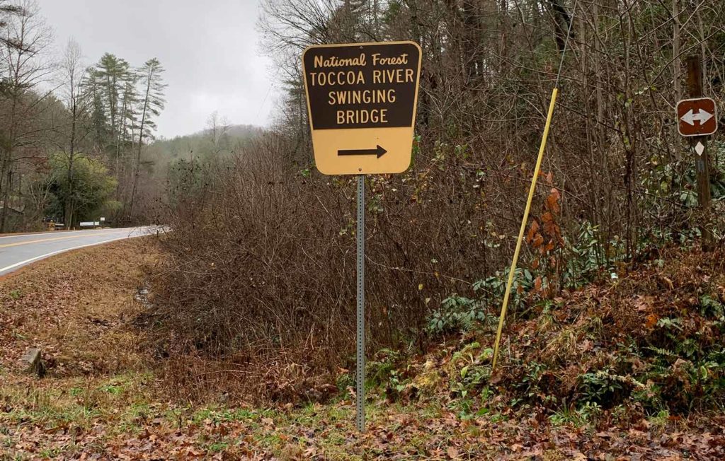
From the intersection of Hwy 515 and Hwy 5 (McDonalds) in Blue Ridge, take Hwy 515 east for 4 miles to the traffic light at Hwy 60. Turn right and go to the stop sign, then turn left onto Hwy 60. Go 1.5 miles into Morganton, then turn right on Hwy 60 South towards Dahlonega for 11.3 miles until you pass Skeenah Mill. Go for 0.7 miles and look out for the sign in the photo to the right. It is visible from Hwy 60. This is Forest Service Road 816. Take it 3.39 miles down to the parking area then hike for approximately another 1/4 of a mile to the bridge.
FSR 816 is rated ‘2 – High Clearance Vehicles’ by the US Forest Service. The road is gravel, but it can be rough depending on the time of year and conditions. A 4×4 vehicle or Jeep is recommended, or at least a vehicle with high ground clearance. Thanks to this article BlueRidgeMountains.com for these directions.
Forest Service Road 816
(Tooni Gap / Toccoa River Swinging Bridge)
■ N 34.76609°
■ W 84.16426°
■ 3.39 miles from road (Hwy 60) to parking area
■ USFS Rated 2 – High Clearance Vehicles
Forest Service Road 816 – Parking Area
■ N 34.73922°
■ W 84.17027°
Toccoa River Swinging Bridge
■ N 34.73697°
■ W 84.16762°
You can also find additional info on the bridge via the two links below as well. Both articles were used as sources for this post.

No Comments