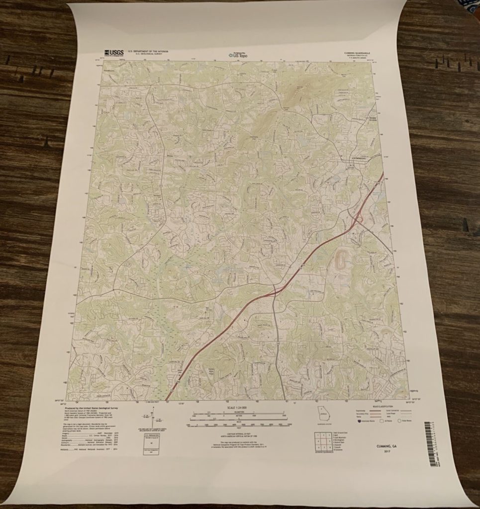
Having a backup copy of paper maps is always a good idea for any trip in remote areas. You never know when your electronic devices may fail, run out of battery or have other issues. I recently spent some time trying to figure out the best way to print USGS (US Geological Survey) topographic quad maps on paper, and after testing a couple of different methods I settled on one – printing the maps full size at Staples.com.
I compared the prices to print the maps at full resolution and quotes ranged from $35+ per map at FedEx Kinkos to $5.94 at Staples… Yes, that is correct. Printed full-size on 24” x 36” paper was only $5.94 at Staples. The map is printed on regular paper, not waterproof paper like Tyvek, but if you are using the maps for backup and have a safe and dry place to store them regular paper should work fine.
I used the GeoPDF format for a local USGS quad to test the process. You can download either GeoPDF or GeoTIFF (image) files directly from the USGS or USFS websites. Here are the links to both sites:
■ USGS – The National Map Viewer
■ USFS – FSTopo
Using the USGS – The National Map Viewer
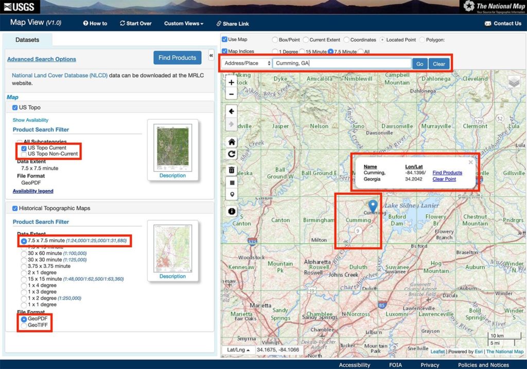
- Go to the USGS National Map Viewer site
- Search for the desired location in the search bar
- Click ‘US Topo Current’ for the current map generation
- Click ‘7.5 x 7.5 Minute’ (current USGS map standard size)
- Click ‘GeoPDF’ for a map in PDF format
- Each one of the squares on the map is an individual topo map. The name of the map is displayed in the center of the square
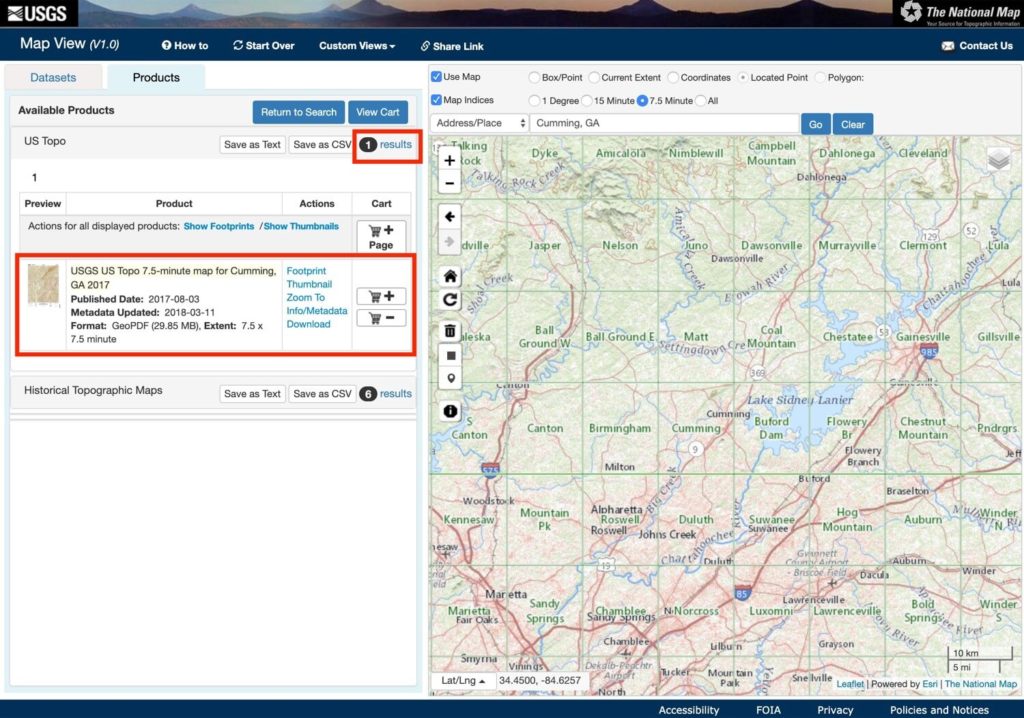
Next, search for available maps and download them:
- Click ‘Find Products’ in the window that appears above the map pin
- You will see the number of matching results (maps) in the ‘Available Products’ window that appears on the left – click the ‘results’ link
- The available maps will display, click ‘Download’
- You can also see historical (older) maps for the area by clicking the ‘results’ link in the ‘Historical Topographic Maps’ section of the ‘Available’ Products’ window
- Note the format and size of the map file (EX: GeoPDF, 29.85 MB)
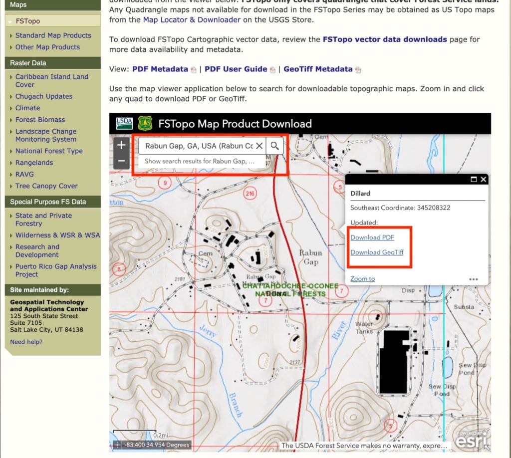
Using USFS (US Forest Service) FSTopo Viewer
- Go to the USFS FSTopo Viewer site
- Search for the desired location in the search bar
- Click on the map image (the actual topo map displays)
- Click the download link for either format – ‘Download PDF’ or ‘Download GeoTiff’
Next, head over to staples.com to create a printing project
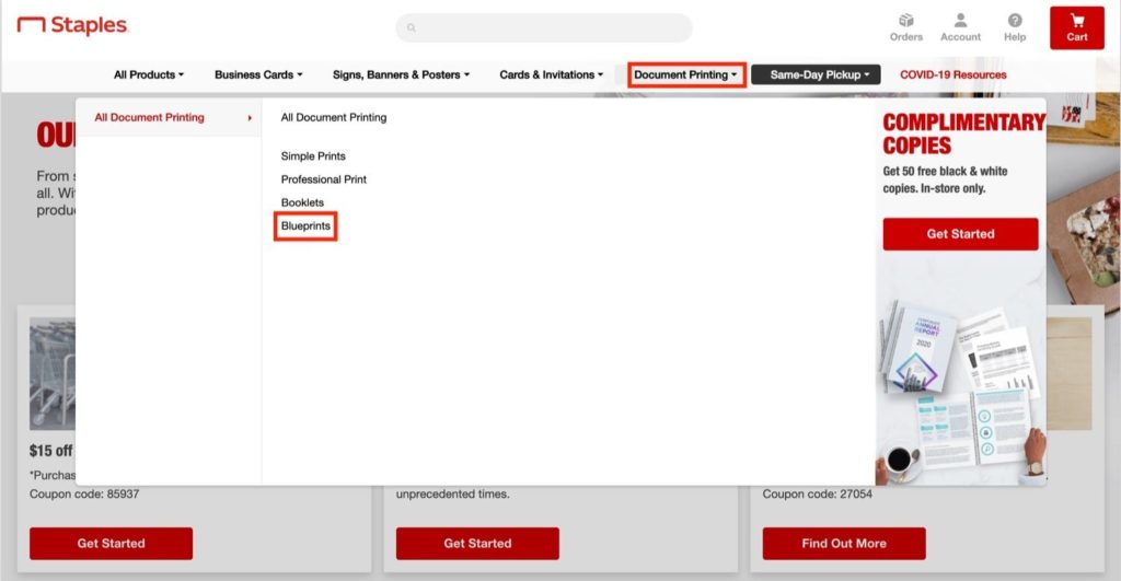
- From the navigation bar click ‘Document Printing’ > ‘Blueprints
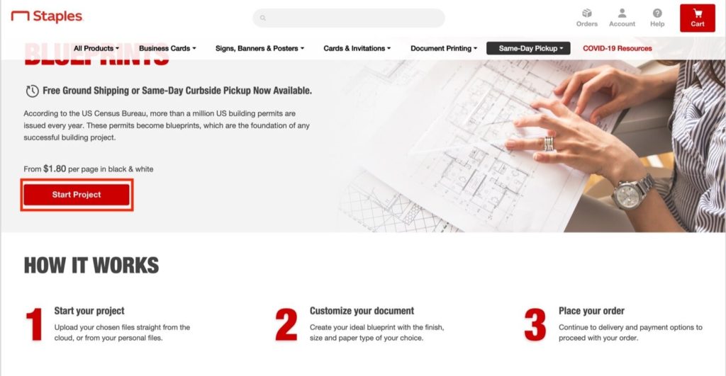
Click ‘Start Project’
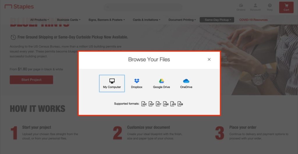
Select the map file(s) to upload for printing
- NOTE: These files are typically large (30-100+ MB) so it may take some time to upload depending on your internet connection
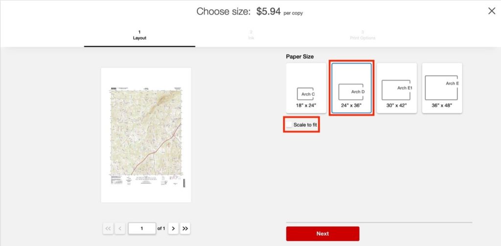
Make the following selections on the preview screen
- Paper Size – 24” x 36” (width x length)
- Uncheck ‘Scale to Fit’ (this will print the map at its native size/resolution and not scale it to make it larger so it fits the entire page)
- NOTE: It’s a good idea to double-check the physical size of the map PDF document to make sure the paper size you select will accommodate the entire map. You can do this either by viewing the file’s properties or opening it in Adobe Acrobat reader and clicking ‘Properties’ from the ‘File menu
- NOTE: Some of the USGS topo quad maps also include a layer for satellite imagery. It usually appears to not be on by default, but if you see the satellite imagery in your map print preview try opening the file with Adobe Acrobat reader and checking the layers to make sure the imagery layer is set to off
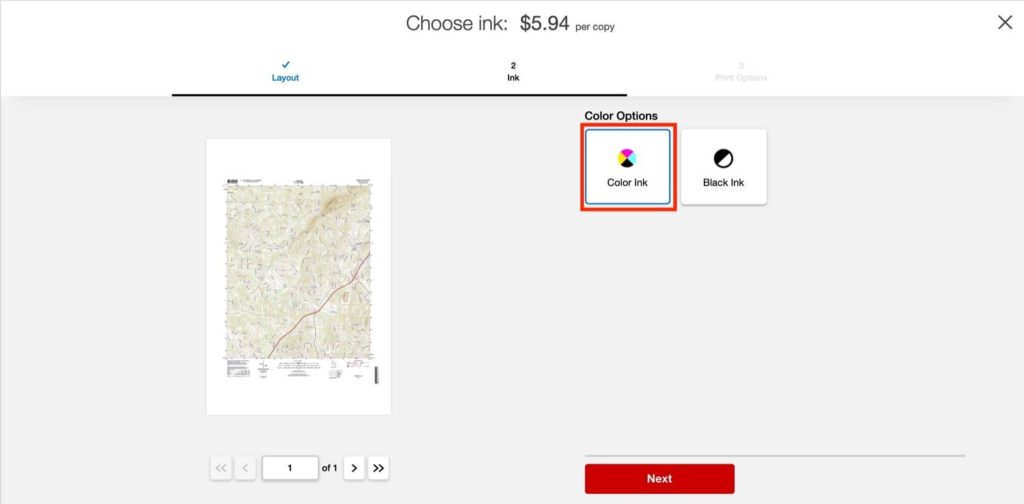
Select ‘Color Ink’
Complete the next 2 screens to select pickup in store or delivery and submit the order. I submitted my order around 9AM and it was ready by 6:30pm the same day.
